
indiemapper
Over at Axis Maps we’ve recently put up a new site to announce a project that will be keeping us busy this spring. It’s called indiemapper.
Indiemapper grew out of a spare-time project that my esteemed colleague Zachary Forest Johnson and I began a little over a year ago in between beer breaks at the University of Wisconsin-Madison. Zach started playing around with loading and projecting shapefiles in Flash, and then I took an interest and joined in. Before long we were envisioning a web-based custom cartography tool, an alternative to the expensive and overly complex GIS that we were unhappily dependent on for making sweet printed or static maps. Zach’s “indiemaps” self-branding provided a name that quite nicely fit our idea.
Anyway, we never got far beyond experiments, and other priorities kept us from working on the project much. Last spring, with Zach’s blessing, the project—name, official Zach Johnson blue (#0099CC), and all—was handed over to Axis Maps. Now we’re finally kicking it off.
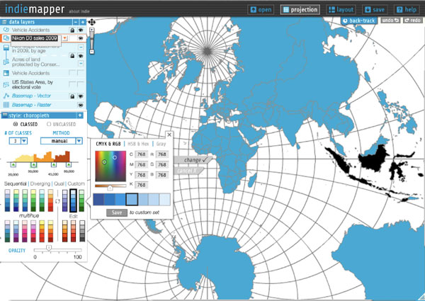
On the indiemapper site we’ve described it as “bring[ing] traditional cartography into the 21st century.” We’re recognizing that printed or otherwise static maps are still very much a part of the practice of cartography, but that the necessary tools for producing such maps are not keeping up with the advances in accessibility and ease of use that have been occurring with collaborative web mapping. (I must, of course, point to GeoCommons here.) When we only need to perform some basic cartographic operations to our data before diving into design work, GIS proves to be a costly headache. With indiemapper, we’re trying to create a much simpler and more satisfying middle step between data and map (or vector artwork). So if you’re a cartographer or ever find yourself acting as one, visit the site to see what it’s about and some early ideas, subscribe to our list to be notified of releases in the future, and keep an eye on the product blog to follow our thoughts and updates as we go.
Tagged axis maps
3 Comments