
Madbridge, Wiscachusetts and Portland, Mainegon
For the next effort from the cartographic sandbox in which I’ve been playing lately, let’s try something ridiculous again. Your typical map, particularly the modern online mashup, exists to show various data that share a common geography. For a change of pace, what about different geographies that share common data?
To claim to have actually thought about this as a mind-blowing inversion of data-physical space would be a rotten lie. But whatever the motivation, I considered the idea by taking the attribute “I lived in this spot,” found the two most recent geographies that match that attribute, and then combined them in a map with a Google-ish style. The result is a section of Madbridge, Wiscachusetts. (That’s Madison, Wisconsin and Cambridge, Massachusetts.)
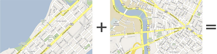
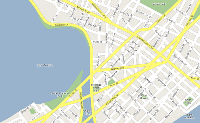
There was deliberate selection of which pieces of each map to include, of course, but these parts of Madison and Cambridge play together rather nicely, as it turns out. Aye, the map’s a keeper for my scrapbook. But nobody besides me is interested in a combined map of the places I have lived.
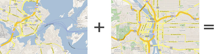
For a more general interest, I thought it might be fun to see what it would look like if different cities of the same name were combined. I tried my hand at a pair of Portlands. I didn’t label this one or include the minor streets because, well, screw that; making these maps can only amuse you for so long. Anyway, here is the city of Portland, Mainegon.
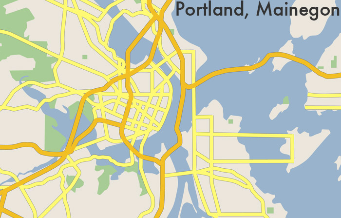
It’s a city marked by long and sometimes meandering bridges. One interesting thing is that even though in the eastern half I’ve pretty much maintained the Maine land and water, Oregon’s I-84 manages to follow an island-hopping route that is not entirely inconceivable. This I take as solid proof that such experiments in cartography are worthwhile and absolutely necessary, and that this city should be carved out and built somewhere.
Cities with the same name are just one way to go. There are or course many commonalities, at varying levels of detail, that link different places and upon which this kind of mapping could be based. And it could go well beyond street locations and physical geography. We could go beyond the map and combine the architecture, flora, and everything to invent complete hybrid places. Imagine the boundless, pointless possibilities!
I could swear I’ve seen somebody do something similar before, but I can’t remember where. Unless it was just in a dream. That is, a dream besides the glorious one I just had the other night as a result of working on this.
Tagged Boston, experiment, frivolous, madison
4 Comments