
Typographic maps
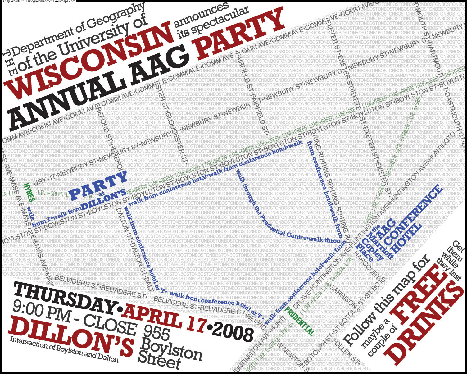
Recently I was asked if I could whip up a small flier announcing the UW-Madison Department of Geography’s traditional party thrown on one night during the Association of American Geographers Annual Meeting (held last month in Boston). I came up with the image at right: a map made entirely of type. It was a hit with the crowd and was easy to make. I simply used Illustrator to trace lines over streets in a Google Maps screenshot, type on those paths, and add the extra type around the edges and in the background.
There are many fun examples of art with typography out there, but type maps in particular are something that you don’t see often enough. (I suppose, though, if it were more common it would lose some of its appeal.) I’m sure there are more than I realize, but here are some examples I’ve managed to find:
- London’s Kerning is a poster that made its rounds on the blogosphere not long ago.
- Ork Posters have neighborhood maps of some cities in which the shapes of the neighborhoods are made up of type.
- Similar to the Ork Posters, but with a bit more flair, is this map of Manhattan neighborhoods. (I haven’t tracked down the source of this one.)
- Continuing on the New York theme, here’s a typographic map of the PATH train lines.
- Mark Andrew Webber is working on a series of linocut prints of typographic maps.
- The Strange Maps blog links to a text map of the Eurovision Song Contest result.
- I found a typographic map in the portfolio of Elena Zubowicz, but unfortunately it’s difficult to see detail.
- Finally, what appears to be a map of visited countries not unlike the city neighborhood maps, in which words fill the country shapes. This is an interesting map outside of typography, as it roughly preserves the shape of Eurasia despite leaving out many countries.
Something on my to-do list of impossible dreams is to see if a basic typographic map could be produced programmatically by reading a shapefile or something. Keep an eye out; maybe something will come of the idea!
Tagged typography
8 Comments