
Zombie psychogeography
I’m very weary of the hipster obsession with zombies by now. Cut it out, hipsters. So I felt shame the other night as my friend and I sprinted through the dark along treacherously uneven brick sidewalks, running from zombies and loving it.
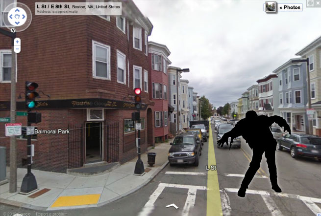
Not real zombies, or even hipsters—we were responding to an awesome app for Android phones called Zombie, Run! It’s a location-based game of sorts that places a bunch of zombies between you and your destination on the map. When you’re near enough to a zombie, it begins to give chase. You must reach your destination without a zombie catching you and eating your brains. It’s lots of fun and can make mundane trips much more interesting, especially if you enjoy running around like a maniac in public.
But a game like this is also fascinating when you set down your can of High Life and put on your Geographer hat. It directs a kind of spatial behavior that technology more often stamps out in one way or another—wandering. While our gizmos usually tell us exactly where something is and how to get there, here is something that forces a person to stray from the direct path. Assuming the player keeps his eyes open and actually notices the world around him, the game provides an interesting way of experiencing and understanding urban spaces. By acting upon virtual landscape in the physical landscape, the player travels unpredicted paths and enters areas that might otherwise never have been seen.
It’s a little like an exercise in psychogeography, a field I can’t really claim to understand but a central activity of which seems to be the dérive, in essence a sense-driven wandering. But here instead of reacting to the sights and sounds and smells of the real urban landscape, a person is influenced by a random set of obstacles beyond anyone’s control. Such randomness may not lead to an especially deep understanding of the city, but its advantage is in ensuring wandering much more free of human biases—perhaps a better sampling of the landscape.
I have a hobby of going on long walks about town in order to check out areas I don’t know well (or at all) and often to capture a photo or three. Most of the time I end up plotting a general route beforehand to ensure that I hit a few key spots and maximize travel on routes I haven’t taken before. Invariably I second-guess myself after the fact. What did I miss by adhering to this route? What made me choose this route? What made me avoid other routes? So recently on what was only my second visit to South Boston, I let the zombies decide much of where I would walk, leaving me with perhaps not a representative impression of the place but certainly the feeling that I got a moderately more real, unbiased look at the neighborhood. Naturally it was an amusing mapping exercise too.
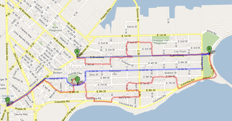
Here is my great Southie zombie adventure. From the point where I switched on the game (A) I had three destinations in sequence (B,C,D). Blue shows the direct route, and red is the GPS track of my actual route.
Apologies to any of you fine Southie people I hurriedly brushed past to escape a close call with zombies. Good thing none of you were angry Irish mobsters like in the movies.
Praise be to mobile technologies that promote discoveries of space and place instead of conveniently simplifying them.
Tagged Boston, exploration, psychogeography, urban geography, wandering, zombies
1 Comment